Generating and using multiple benefits layers: Using Key Biodiversity Areas and protected areas datasets
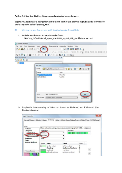
This is a simple GIS tutorial relating to the exercise on Identifying areas where a REDD+ action to conserve forests could result in biodiversity conservation benefits.
Download the resource
Format: application/pdf
Size: (1.531 MB)
Size: (1.531 MB)